CITY HEIGHTS, SAN DIEGO
City Heights, San Diego is comprised of 16 neighborhoods made up of diverse individuals, families, and businesses. Each neighborhood has its own unique history. City Heights is located in Council District 9.
|
|
|
AZALEA PARK
AZALEA PARK
The Azalea Park neighborhood is one of the best-kept secrets in City Heights. Manzanita Canyon and Hollywood Canyons provide natural boundaries that give this neighborhood a secluded feeling. The Azalea Park Recreation Center and Park are the focal points for this neighborhood. A walk around the beautiful garden is very peaceful and shows how much this neighborhood cares for its surroundings. If one drives through the neighborhood one can also make a game of trying to see all the signs that were put up commemorating the floral street names. Each floral street has a sign of its own such as Violet, Tuberose, and Shamrock (to name a few).
BAYRIDGE
BAYRIDGE
Bayridge consists of 160 duplex townhomes with 2, 3, and 4 bedroom floor plans. Bayridge is located just minutes from downtown San Diego and adjacent to the community of Fairmount Park with nearby access to Interstates 15 and 805 and State Route 94. The neighborhood includes a private park area consisting of a tot lot, green space, and a large swimming pool. The park is for the exclusive use of Bayridge residents and residents may bring guests with them to the park.
CASTLE
CASTLE
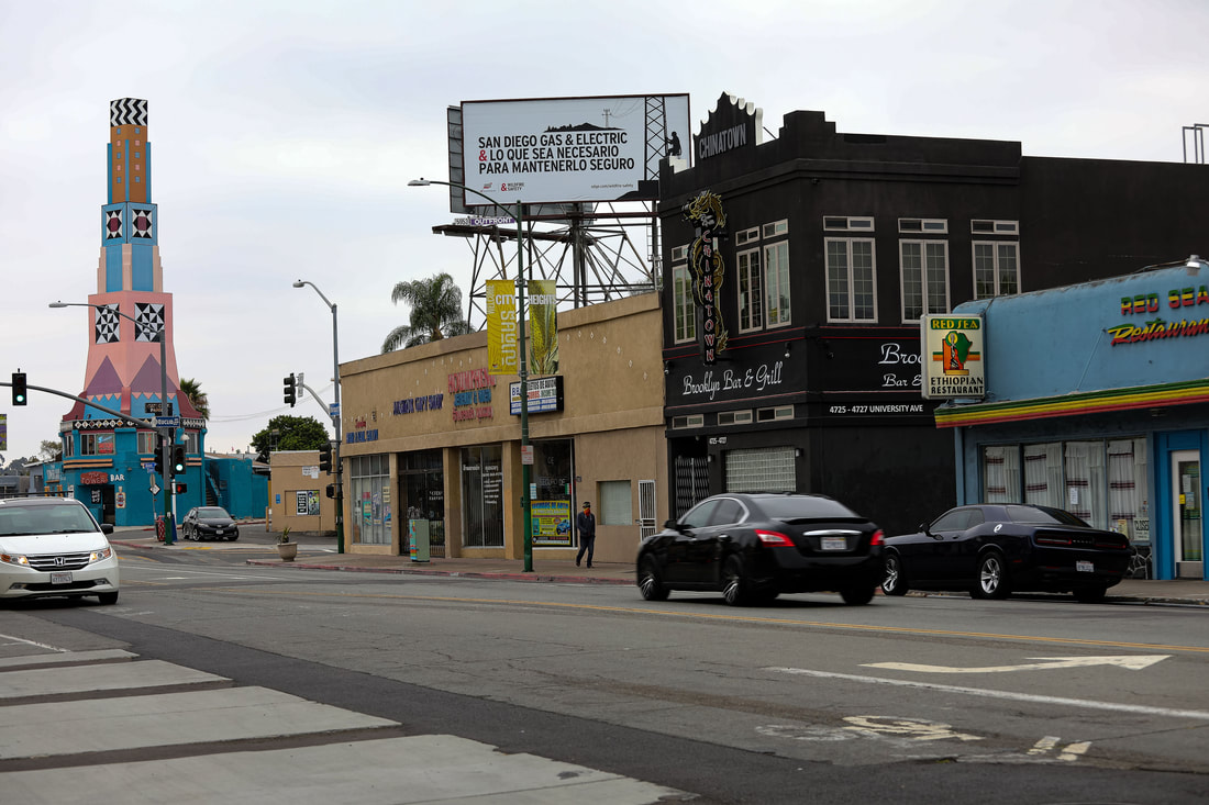
The Castle neighborhood in City Heights has many distinct homes that are castle-like in appearance. Homes with turrets and battlements are some of the unique features that one will see in this neighborhood. The area also has a large number of Spanish style homes, since this area was largely developed in the 1920s and 1930’s when that style was most popular. The commercial core of the Castle neighborhood is located on Fairmount and University Avenues. This area has seen large scale re-development projects in the recent past, and it has been revitalized with the added developments. Castle’s neighbor to the north is Teralta West, and to the South it is Azalea Park. The eastern boundary is Fairmount Village. The western boundary includes the 15 freeway and Cherokee Point.
Click here for more information on Castle.
Click here for more information on Castle.
cherokee point
CHEROKEE POINT
The Cherokee Point neighborhood is made up of mostly single-family homes. The majority people keep up the front of their homes with well maintained front yards. Cherokee Point is home to Park De La Cruz and a skatepark. Cherokee Point Elementary is a brand new state-of-the-art school that is the pride of the neighborhood. Cherokee Point is shaped like a wine glass with the mouth of the glass making up University Avenue on the northern boundary. The other boundaries are the 15 freeway on the east and the 805 freeway on the west. The freeways cross at the bottom of the “wine glass.”
CHOLLAS CREEK
CHOLLAS CREEK
The Chollas Creek neighborhood got its name from the arborescent cacti that grow in Chollas Creek. Chollas Creek is a 30-mile watershed that winds its way from Lemon Grove to San Diego Bay. The neighborhood of Chollas Creek is on the eastern edge of City Heights and shares boundaries with Ridgeview, Islenair, Fox Canyon, and Colina Del Sol.
Click here for more information on Chollas Creek.
Click here for more information on Chollas Creek.
COLINA PARK
COLINA PARK
The Colina Park neighborhood is home to the large Colina Del Sol Park, which boasts tennis courts, a recreation center, a disc golf course, and a golf course. The City Heights Community Development Corporation is in the first stages of planning a low-cost neighborhood shuttle that will operate within the neighborhood and connect residents to nearby businesses. The Latino, Vietnamese and African businesses along University Avenue and El Cajon Boulevard reveal our truly multicultural colors.
Click here for more information on Colina Park.
Click here for more information on Colina Park.
CORRIDOR
CORRIDOR
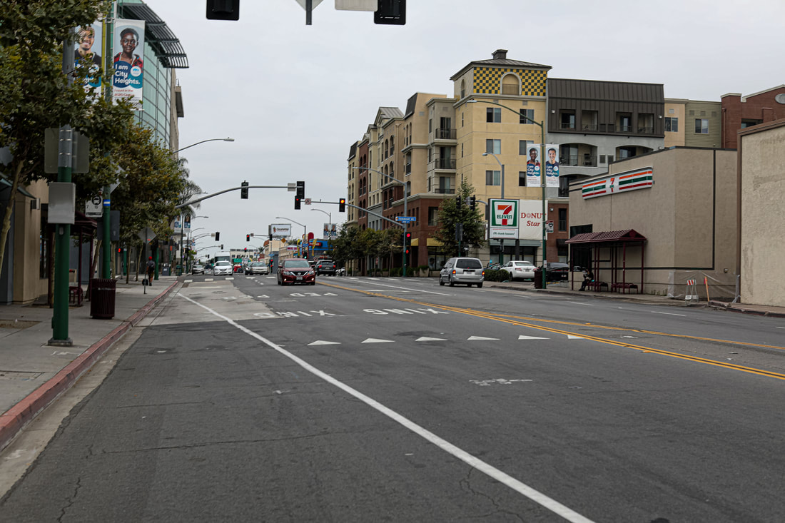
The Corridor neighborhood is at the western tip of City Heights and is a mix of residential and commercial. Each of the commercial corridors has its unique feel. University Avenue has a dense mix of small businesses that cater to a large immigrant population. El Cajon Boulevard has some bigger national chain stores with a mix of small businesses. Sandwiched between these streets is a mix of single-family and multiple housing dwellings. Corridor has seen an upswing in recent years of neighborhood development that has greatly improved the area. The boundaries are the 805 and the 15 freeways on the east and west. El Cajon Boulevard and University Avenue are the northern and southern boundaries.
FAIRMOUNT PARK
FAIRMOUNT PARK
The Fairmount Park neighborhood was first established in the early 1950s and has over 500 single-family homes. Construction in the 1980s filled in most of the remaining real estate—developing almost the whole neighborhood.
There were no highways when the neighborhood was built, but now Fairmount Park is surrounded on all three sides by major freeways. You might say that Fairmount Park is the other “Golden Triangle”! Home Avenue is the main thoroughfare of the area and serves as the neighborhood’s business district.
In April, the neighborhood hosts an annual Whole Neighborhood Yard Sale that brings everyone together for fun and the thrill of finding bargains. Then, in June, the Fairmount Park Neighborhood Association, in conjunction with our City Council Member's office, coordinates a neighborhood cleanup that allows for residents to bring large items for disposal that otherwise would have to be hauled to the Miramar Landfill or remain an eyesore on local properties.
Fairmount Park is unique due in its distinction of having the highest owner-occupancy rate in City Heights. Even though the neighborhood is over 50 years old, several of the original residents still reside here and now, some homes in the area are owned by different generations and branches of the same families.
The Fairmount Park Neighborhood Association holds monthly meetings. For more information, please email: [email protected].
FAIRMOUNT VILLAGE
FAIRMOUNT VILLAGE
Fairmount Village’s north-south boundaries are University Avenue to Thorn Street. The east-west boundaries are Fairmount Avenue to Euclid Avenue. The neighborhood was developed at the turn of the century and was annexed by the City of San Diego in 1926. As a result, there is a mix of homes throughout the neighborhood ranging from cute craftsman cottages to mid-century ranches to multi-family apartment units.
Fairmount Village possesses excellent parks, recreational facilities, and a great shopping center—making the neighborhood very walkable, and safe, at all times day or night. The library puts on summer movie nights that are always popular. Fairmount Village also has soccer competitions, arts and cultural performances, and food events. Fairmount Village also has two San Diego Unified schools within its boundaries; Rosa Parks Elementary and Monroe-Clark Middle School.
The neighborhood also has canyon trails that are home to many native species of mammals and birds. The 47th Street canyon is a particularly nice canyon for a short hike.
FOX CANYON
FOX CANYON
Fox Canyon is home to the historic Egyptian Garage and Euclid Tower. The neighborhood is located south of University Avenue and bordered by historic Islenair to the south and Euclid Avenue to the west.
HOLLYWOOD PARK
HOLLYWOOD PARK
Hollywood Park is one of the smallest of the neighborhoods of City Heights. The area's main feature is Hollywood Canyon. Hollywood Canyon is a beautiful canyon that runs the length of Hollywood Park. Most of the homes in this neighborhood have canyon views and give a sense of countryside in the middle of the city.
ISLENAIR
ISLENAIR
The City designated historic district of Islenair reflects San Diego’s small house movement. Most of the homes in the area were built between 1926 to 1952. The architectural trends of the neighborhood are Spanish eclectic, minimal traditional and Ranch Style house types. The houses in this area were designed with quality in mind, and the neighborhood has retained its charming neighborhood feel. The Islenair historic district is located along Euclid Avenue; Belle Isle Drive; Isle Drive; Isla Vista Drive; and Thorn Street.
Islenair means "Island in the Air," which is a reference the land high above Chollas Valley surrounded by three sides by open canyon space. The neighborhood was developed in response to a growing demand for semi-rural, community-centered way of life ad advances in transportation technology made development in outlying communities both affordable and practical. Developers and real estate investors James Love and William Touhey planned Islenair as a self-contained, mixed-use subdivision, taking advantage of their location on Euclid Ave by allowing a variety of uses including business, “semi-business,” and multi-family uses.
Islenair reflects the diversity of City Heights as a whole, and includes property owners and renters from a wide range of cultural and ethnic backgrounds, illustrating the ethnic and cultural evolution and integration of City Heights and San Diego as a whole. Islenair is the only neighborhood in City Heights to be designated a Historic Community by the City of San Diego.
“Islenair is a small, working class, early auto-oriented suburb that reflects the small house movement which took hold following World War I and became a national standard of development in the wake of the Great Depression and the Post-World War II housing shortage.” [1]
RIDGEVIEW
RIDGEVIEW
The Ridgeview neighborhood is situated on a mesa and surrounded by the canyons of Chollas Creek.
This neighborhood has a community garden that the residents share—a charming addition to the area. The neighborhood is mostly made up of single-family residences and is considered a very walkable neighborhood. The main access points for Ridgeview are Ridgeview Drive and Federal Boulevard.
This neighborhood has a community garden that the residents share—a charming addition to the area. The neighborhood is mostly made up of single-family residences and is considered a very walkable neighborhood. The main access points for Ridgeview are Ridgeview Drive and Federal Boulevard.
SWAN CANYON
SWAN CANYON
Swan Canyon encompasses the boundaries of Fairmount Avenue to Euclid Avenue, Thorn Street, to Home Avenue.
Founder, Becki Schwartz grew up in the Swan Canyon area. During those years City Heights was a peaceful, family-friendly neighborhood. Neighbors knew each other, kids stayed out until porch lights came on. Neighbors looked out for neighbors.
Schwartz grew up and moved away to pursue her college goals. She returned in 1995 with her husband and baby. When she returned to the family home, she was shocked by the changes that occurred in her absence. Neighbors no longer spoke. Graffiti marked the corners and litter filled the street ways and canyons. Children no longer laughed together, and doors stayed locked. Having learned about neighborhood watch in her Culver City home, she decided it could be done in San Diego too. She was unaware of the work that was already being done by the City Heights Town Council (CTHC). She passed out flyers door-to-door and held the first meeting at Hamilton Elementary.
Momentum was building and more people became involved. The CHTC sent representative Michael Sprargue to support her efforts. In learning of all the services that the CHTC could assist, the Swan Canyon Neighborhood Association expanded. Faith Webb-Calloway joined in the effort and the organization took off. Key representatives were identified on most of the streets in Swan Canyon. A newsletter with local information and ads for the businesses was delivered monthly. The organization also obtained grants from the San Diego Foundation for projects, performs canyon clean-ups and street and graffiti clean-ups. The organization now meets as needed.
TERALTA EAST
TERALTA EAST
Teralta East has its borders of El Cajon Boulevard on to the north and University Avenue to the south. Fairmount Avenue is the western border, and Euclid Avenue is the eastern border. Teralta East has as its core the Little Saigon Cultural and Business Center. The area has a strong Vietnamese presence as well as a growing Somali community.
TERALTA WEST
TERALTA WEST
The neighborhood of Teralta West is one of the better knowns of the 16 neighborhoods of City Heights.
The commercial district of El Cajon Boulevard and University Avenue, respectively, make up the northern and southern boundaries. The eastern boundary is Fairmount Avenue, and the western boundary is the 15 freeway. Teralta West started life out as East San Diego in the 1880s as a rural suburb of San Diego. The neighborhood was an important commercial center during the 1930s, 1940s, and 1950s.
There are many houses that still date from the early part of the 19th century as well as bungalows from the 1920s, 1930s and 1940s. Teralta West is currently a mix of single family dwellings, multi-family residential and commercial areas.